Tracing the ridgeline of the 1,000-meter high Sekida mountains of Northern Nagano and Niigata is the 110-kilometer-long Shin-etsu Trail.
Traveling from Mt. Madarao in Iiyama City to Mt. Naeba in Niigata, the trail passes through varied natural terrain such as mountain-top beech tree forests, highland marshes, fields of rice paddies and hamlets of farmhouses in the heart of Japan’s Snow Country.
The trail is divided into ten sections, each of which can be hiked in a single day, and accommodations and tent sites near the trail make it easy to take multi-day treks.
Walk along the Shin-etsu Trail and take in the lush natural scenery and history of this unique region.
Shin-etsu Trail Overview

Carving a path over the Sekida mountains, the Shin-etsu trail crosses 16 historic mountain passes—some official checkpoints, others old smuggling routes—on the border of Nagano and Niigata prefectures from Mt. Madarao to Mt. Naeba.
The 110-kilometer-long trail is divided into ten sections. A single section (or two) can be completed in a day, and longer stretches of the trail can be completed with stays in nearby accommodations or tent sites along the way.
The sections, their distance and average hiking time are as follows:
Section 1: Mt. Madarao to Akaike Pond (8.5 km; 4.5 hrs)
Section 2: Akaike Pond to Wakui (11.2 km; 5 hrs)
Section 3: Wakui to Hotoke ga Mine Tozanguchi Trailhead (12.6 km; 6-7 hrs)
Section 4: Hotoke ga Mine Tozanguchi Trailhead to Sekida Toge Pass (8.2 km; 6-7 hrs)
Section 5: Sekida Toge Pass to Busuno Toge Pass (12.4 km; 6.5 hrs)
Section 6: Busuno Toge Pass to Mt. Amamizu (12.8 km; 6 hrs)
Section 7: Mt. Amamizu to Mori-Miyanohara Station (7.2 km; 5-5.5 hrs)
Section 8: Mori-Miyanohara Station to Ketto (17.2 km; 6.5-8.5 hrs)
Section 9: Ketto to Koakasawa (9.7 km; 6 hrs)
Section 10: Koakasawa to Mt. Naeba (8.5 km; 6-7.5 hrs)
See details about each section on the Shin-etsu Trail Club website.
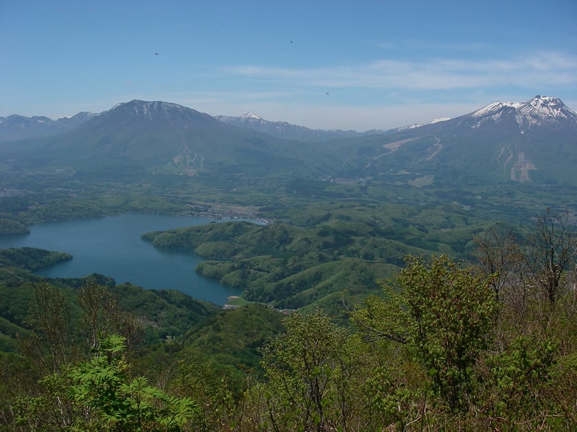
The Unique Landscape of the Shin-etsu Trail and Japan’s Snow Country
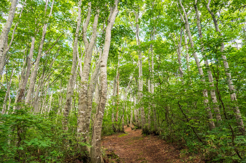
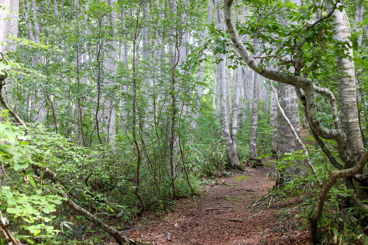
Beech forests in the Sekida mountains
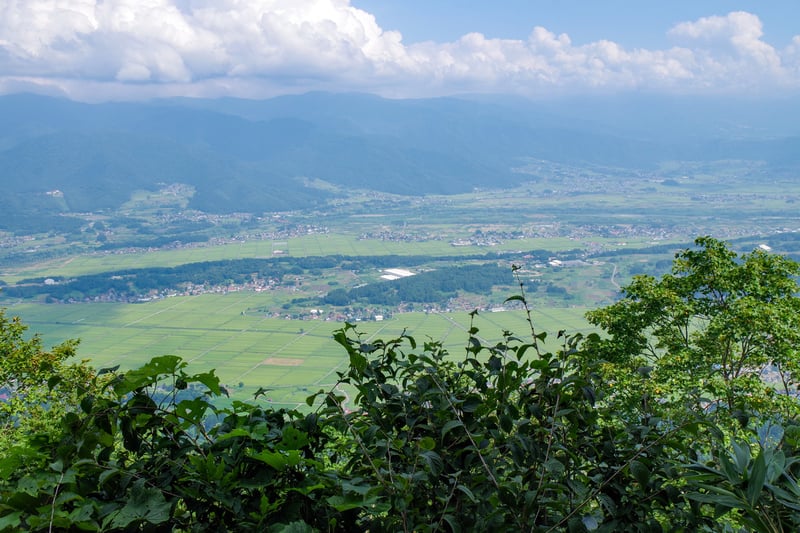
Rice fields in the valley below
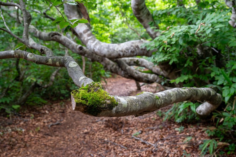
Warped trunks of snow-battered trees
The natural environment surrounding the trail is known as Japan’s Snow Country. Despite the relatively low latitude and altitude here, heavy snowfalls are common, and up to 10 to 20 meters of snow can accumulate in some parts of the region.
Some plants are better adapted to surviving the deep snows, and along the Shin-etsu Trail, they account for much of the foliage you’ll see around you. Beech trees in particular have thrived in this environment; their warped trunks a testament to the weight of the white blankets of winter. Other plants, such as sasa bamboo grass, are flexible enough to weather the snows and bounce back in spring. The tall beech and low-lying bamboo grasses form spacious and bright sections of forest—a highlight of the region and the Shin-etsu Trail.
The trail also runs near local settlements and crosses old mountain passes, so the area’s history can be felt here as well. A towering cedar tree, planted to mark an unofficial mountain pass, stands out among the surrounding beeches—its evergreen leaves and height making it easy to spot any time of year.
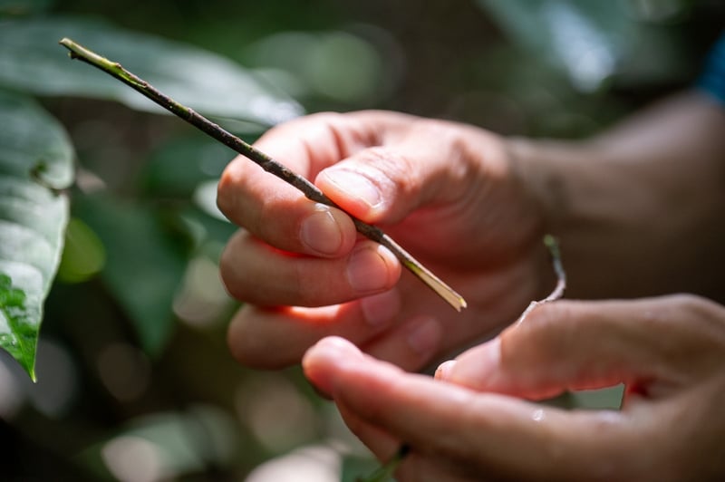
A fragrant branch of kuromoji (Lindera umbellata)
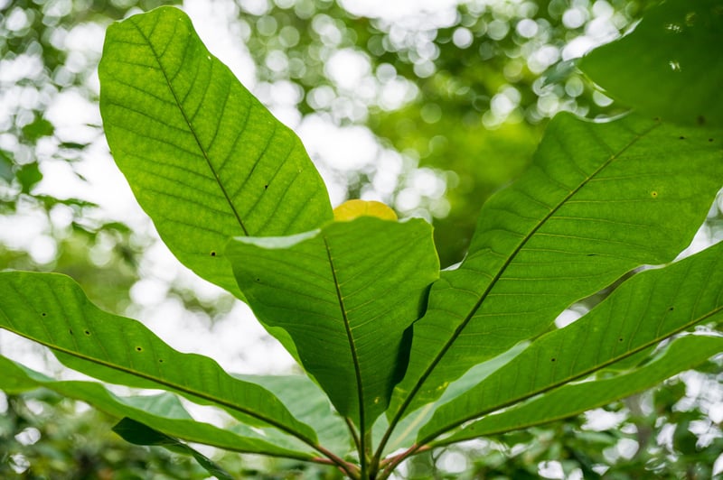
Leaves of the Japanese bigleaf magnolia (hō-no-ki in Japanese)
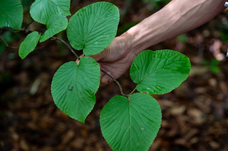
Viburnum furcatum (ōkame-no-ki in Japanese)
Some smaller plants such as kuromoji were frequently used as medicine (its branches are now used as an aromatic toothpick-like utensil for wagashi sweets). These may be hard to spot on your own, but a guide can teach you much about the local flora and their uses by locals.
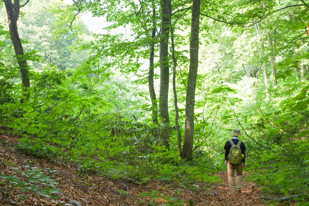
Recommended Routes along the Shin-etsu Trail
Not everyone has the free time or stamina to do a full 110-kilometer hike across the Shin-etsu Trail. We’ve included some of the most popular routes below, from day hikes of a single section to multi-day treks.
Section 1 (Mt. Madarao to Akaike Pond)
(©The Shin-etsu Trail Club)
Distance: 8.5 km (total 10.5 km)
Starting Point: Mt. Madarao (Tyrol trailhead)
Ending Point: Akaike Pond
Estimated Hiking Time: 4.5 hours (total 5.75 hrs)
The first section of the Shin-etsu Trail offers plenty of varied terrain and scenery, from mountaintop views to beautiful beech forests and wide-open marshes. It is also one of the most easily accessible sections, with regular bus service from Iiyama Station to Madarao.
There are several trails to reach the top of Mt. Madarao, but most will take the Tyrol trailhead through the ski resort. It is about 2 kilometers to the top and the climb takes about 1.2 hours. This climb isn’t included in the official route, adding to the total distance and time for the section.
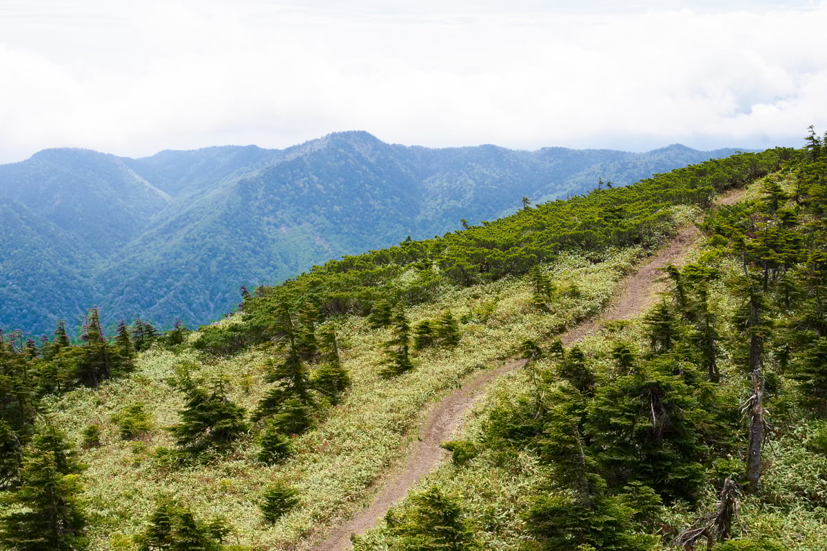
After reaching the summit, the Shin-etsu Trail begins as you descend towards Manzaka Pass. The trail then passes through the Hakama Wetlands and summits 1,135-meter-high Mt. Hakama before flattening back out as it approaches Akaike Pond.
Section 4 Partial (Sekida Pass to Mt. Nabekura)
Distance: 5 km
Starting/Ending Point: Sekida Pass
Estimated Hiking Time: 3.5 hours
Section 4 of the Shin-etsu Trail becomes a bit wilder and features a steep incline at the onset coming from Section 3. However, starting from Sekida Pass at the end of Section 4, you can make an easier round-trip hike to Mt. Nabekura. This densely forested section has plenty of beech trees, nice views of the Hikarigahara highlands in Niigata, as well as one of the area’s historic, unofficial passes.
The Mori no Ie accommodation is also relatively close to Sekida Pass, making it a good place to stay. You can also take advantage of shuttle service from the accommodation to the pass and back.
Sections 2 through 4 (Akaike Pond to Sekida Pass)
Distance: 22 km
Starting Point: Akaike Pond
Ending Point: Sekida Pass
Estimated Hiking Time: 17 to 19 hours
This two- to three-day trek along the Shin-etsu Trail is one of the most popular multi-day options. The hike begins from Akaike Pond and meanders through Numanohara Wetland and past Lake Nozomi before making a short climb to Mt. Kenashi. The mountaintop offers picturesque views of valley below.
On Section 3 from Wakui to Hotoke ga Mine Tozanguchi, the mountainous path weaves through forests, opening up to incredible views of rice fields covering the countryside—especially beautiful in late May when flooded with water. The path continues along several small ponds and wetlands.
Finally, Section 4 enters some of the region’s beautiful beech forests as it makes a steeper climb up to Kozawa Pass and Mt. Nabekura. The dense forests are full of natural obstacles, like twisted beech trees and exposed roots, and occasionally thin out to reveal scenic landscapes.
There are numerous accommodations not far away, as well as plenty of facilities along the trail to make the trek more comfortable.
Map and Access
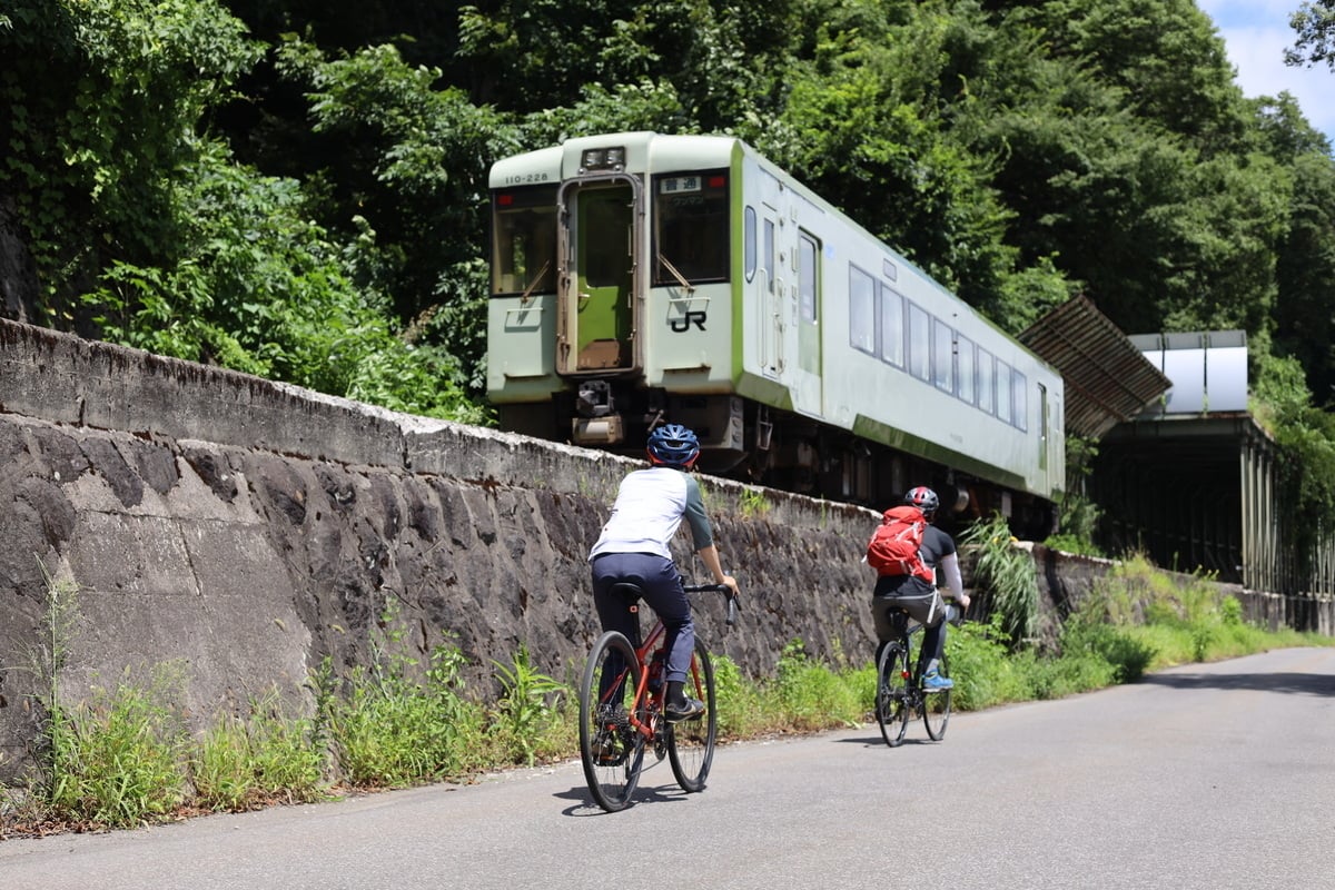
The Shin-etsu Trail travels from Madarao Kogen in Iiyama to Mt. Naeba in Niigata Prefecture. From Sections 1 to 7, the trail roughly follows the JR Iiyama train line from Iiyama Station to the south to Morimiyanohara Station in the north. Then, sections 8 to 10 head away from the train line southeast as they approach Mt. Naeba.
Depending on the section you plan to hike, one of the stations between Iiyama and Morimiyanohara will be closest to the trailhead. Accommodations around the trail also offer pick-up and drop-off service as well.
See access from major cities to Iiyama below:
Tokyo to Iiyama
Take the Hokuriku Shinkansen train from Tokyo Station to Iiyama Station in 1 hour and 40 minutes.
Nagoya to Iiyama
Take the Limited Express Wide View Shinano train from Nagoya Station to Nagano Station (3 hours), then take either the Hokuriku Shinkansen (12 min.) or JR Iiyama line train from Nagano Station to Iiyama Station (50 min.)
Kyoto/Osaka to Iiyama
Take the limited express Thunderbird from Shin-Osaka to Tsuruga Station (77 min.), then take the Hokuriku Shinkansen from Tsuruga to Iiyama Station (139 min.). Or, take the Tokaido Shinkansen from Shin-Osaka to Nagoya, then follow the steps above.
When to Visit
Snow accumulates on the mountains during winter, so the best time to walk the trail is after the snow has melted. Sections 1 and 2 can be hiked from the end of May to the end of November. Sections 3 to 9 can be hiked from the end of June to early November. And the final Section to the peak of Mt. Naeba can be hiked from the end of June to mid-October.
Autumn is one of the most popular times of year to walk the trail due to cooler temperatures and vibrant foliage. The heat of summer dissipates by late September, and autumn leaves reach their peak around mid-October to early November.
Places to Stay along the Trail

Many accommodations around the Shin-etsu Trail are members of the Shin-etsu Trail Club and offer pick-up/drop-off services for nearby train stations and trailheads. You can hike different sections of the trail each day and return to the same accommodation, allowing you to take just a day pack and leave any heavier items in your room. It is recommended to contact the accommodation in advance to make sure your itinerary is possible.
Below are Shin-etsu Trail Club member accommodations with English websites:
Madarao/Tangram Area (Closest Sections: 1, 2 and 3)
Madarao Kogen Hotel
Hotel Tangram
Madarao Mountain Lodge
Guesthouse Maroudo
Pension Pure
Madarao Elm
Togari Area (Closest Sections: 3 and 4)
Togari Onsen Shikisainoyado Kanoe
Hunters Gate
Nabekura Kogen Area (Closest Sections: 4 and 5)
Nabekura Kogen Mori no Ie
Nozawa Onsen Area (Closest Sections: 4 and 5)
Nozawa Holidays
Kijimadaira Area (Closest Sections: 2)
Miyuki no Mori Youth Hostel
Tent Sites on the Shin-etsu Trail
If you’re planning to carry your own tent and sleeping bag, you can utilize the eight tent sites located along the trail. See more details about tent sites here.